Sunday, January 17, 2016

Explored: Corregidor Island

My second trip for the year lead me to an Island, west of Manila Bay. It's proximity from the metro is pretty close as it is 75 mins fast craft travel from Manila Bay. Corregidor Island played a major role in history of the Philippines, most especially in World War II. The tadpole-shaped island is also known as the Rock. It has also a lot of things to offer in just one stop that can be enjoyed in a day trip. The coasts of Mariveles, Bataan is overlooking from the island and the mighty Mt Mariveles is clearly seen when the sky is clear. The other side of the dock has Caballos Island not far. Though it may be seemingly close to Bataan, Corregidor Island is part of the Province of Cavite. 

Run Corregidor recently concluded. It was also that same event when I tagged along with my friend to visit the Corregidor for a running event around the island. 


How to get to Corregidor Island

There are few ways getting to the island; ride a ferry from Manila Bay or hire a pump boat from the coast of Bataan. If you are in Metro Manila, then it is recommended to take the ferry like I did.

Via Ferry

Sun Cruise is the best and most convenient way to visit Corregidor Island. They currently dock at One Esplanade in SM Mall Of Asia. 

Daily Schedule:

Check-in time & Boarding time

ETD Manila

ETA Corregidor 

ETD Corregidor
ETA Manila

Boarding closes 30 minutes of departure. Make sure to be their on time. 

7:00 AM
8:00 AM
9:15 AM
2:30 PM
3:45 PM


New location of Sun Cruise 

Inside the lower deck of Sun Cruise

Tramvias greets you once you off load from the ferry
Sun Cruise docks in Corregidor Island
How to get around Corregidor Island

Frankly, spending an overnight in Corregidor Island is what I likely to recommend so that you can maximize your stay on the island. Star Cruise offers tour packages with buffet lunch and if convenience is what you are for, you can avail for their services. But for those on the budget side and wants the full throttle Corregidor experience, then here is a treat for you.


Tramvias are the tram looking buses that roams around the island

The tour package would normally be for 3 hours around the island. If you like spending long walks, touring around the island is not an impossible thing to do. It may require time, a lot of time, but you will be able to see the island leisurely at your own pace. You make spend time walking around 4 hours around the topside and bottom side may take about 2 hours.  Biking around the island as well is one of the best ideas. You can bring your bicycle with you and tour the island on you own. 


What to see in a Corregidor Island

Aside from the convenience of touring the island, guided tour has a tour guide that tells you the history of the island and what had transpired in the past. 

Artillery Battery

Dilapidated Barracks 


Ammunition inside the Museum


the lighthouse and the highest peak in Corregidor Island

Pacific War Memorial

 
the famous Malinta Tunnel

Bottomside view from the Japanese Garden of Peac, overlooking Caballo Island

Where to stay in the island

There are known to be five accommodations in the island which as a price range of  350-3000 php. But if you are looking for the cheapest accommodation in the island yet being close to Mother Nature, it would be pitching a tent. The island has a camping ground near the beach side. There is a minimal camp fee you need to pay. Tent rental is also available.


Where to dine in the island

La playa restaurant has buffet meals offered. It is the island's only restaurant available in the area. Another option is the carinderia near the beach side. Eating in the carinderia is cheaper than in the resto. You may want to consider bringing packed lunch, some canned goods, water and pichi-pichis. 

Other activities:
Aside from the historical sites, optional activities can be enjoyed in the island. Swimming and snorkeling on the beach shouldn't be missed. The entire island is picturesque and it has one of the best places for photo shoots too. 

Optional Activities:

Lights and Sound Show at Malinta Tunnel - Php200.00/person
The Rocket (Zipline) - Php100.00/person
Outdoor Activities (Sunset and Sunrise viewing, Tunnel Lateral Tour) - Php250.00/person
Kayaking - Php500.00/hr.
ATVs (All-terrain vehicle) - Php500.00/hr


DIY Suggested Overnight Itinerary

Day 1
0800     ETD from Manila
0915     ETA in Corregidor, check inn, setting up the tent, lunch
1300     Explore the bottomside of the Island. 
             Malinta Tunnel, Japanese Garden of Peack, Docks and the Church
1700     Afternoon swimming and prep for Dinner-- free time ahead--

Day 2
0500   Jump start for the day, wait for the sunrise
0530   Start you trek up to the topside, it is roughly 10 km vice versa from the campsite
0630   Middleside: Ruins, Battery Way
0830   Topside: Old Barracks, Museum, Pacific War Memorial, Lighthouse
1100   Back to the campsite, lunch and bound home
1430   ETD from Corregior Island
1545   ETA in SM MOA One Eslplanade

DIY Suggested Overnight Expenses (camp out)

P 1700     ferry transfer with Sun Cruise, entrance fee
P 300       camp fee
P 500       tent rental (optional)
P 500       food & drinks*

*it is better to bring your own water so that don't need to buy one there. 1.5L to 2L would be enough for the overnight. There are souvenir shops around in the island. These shops sell some beverages.

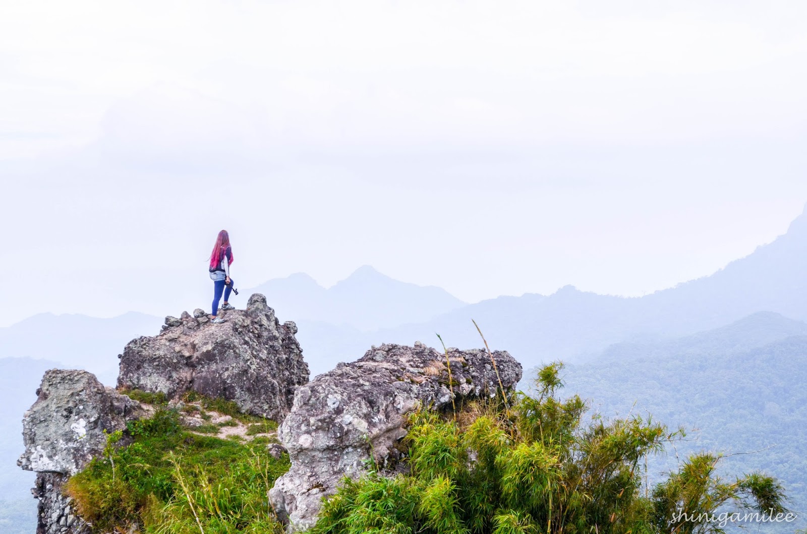
Now, off to a new destination

I bet I will be back in this island. Surely, I will. There is still going to be Run Corregidor in 2017!

Wednesday, January 13, 2016

Run Corregidor

Corregidor Island as one of the places near Metro Manila I wanted to visit. So when I saw my friend was going to a half marathon run there, I grabbed the chance to tag along. I am so glad I did go.

Official Run Corregidor Poster
Run Corregidor 2016 recently concluded. It was last January 9-10, 2015 at Corregidor Island, Cavite.The Corregidor Marathon (42k event) was held on the first day while the International Corregidor Half-Marathon (21k and 10k events) was on the second day.

Race Participants on the second day event are getting ready for the gun time

Since my friend will join the second day event, we decided to do an overnight. All hotels in the island were fully booked so we opted for camping out in the field. It is cheaper and we did not regret it. It is an advantage for participants to do an overnight than come in the morning. There is a social gathering the night before. It is definitely a good time to meet fellow enthusiasts with the sport. Not only that, you don't need to wake up so early and consider the travel period from the coast of Manila to the island. 


#squadgoals
If you want to run fast, run faster.
I wanted to tour the island at least a portion of the island by foot. So while the runners are doing their thing, I did mine. I took some snapshot of the runners I cam across by while I was on my way up too the topside and back to the camping grounds.

Next year, I am going back to this Island Not as a spectator but a event participant. Run Corregidor is now on my list of event to join in 2017 and a highly recommended race too. Not only you experience new challenge running through unpredictable winding up hill and downhill road, you also get to enjoy the scenic view of the Island.
surprised me when he passed by on his 10km

#relationshipgoals
random cool ways for a snapshot

The King and Queen of the Rock 2016. 


For more pics, check out the album in my FB Page here. If you have pics, feel free to tag and grab. Just dont forget to credit Leeisure. :)

Saturday, December 5, 2015

Conquered: Mt Marami! Trek & Treat Climb


Another day hike to add up on my list of adventure and this time, my friends and I headed south. It was the first day of the month and despite the weekend holiday, it was a hassle-free commute. It has been a tradition in the Philippines to visit the memorial and cemetery on this weekend. Thus, it was a Trek & Treat day for us.  The climb was not that toxic since it was only us and another group who climbed the mountain that day. 

It was slightly overcast the whole trek which was really an advantage on our part. I couldn't imagine how it would be a fun trek if  it were raining hard or if the sun was shining brightly as its best. I heard and have read a few review about it, it seemed to be traumatic for a few. This trail though is used for trail runs and indeed a good practice area especially for those who wants to train for rough terrain.

Mt. Marami is at Maragondon, Cavite; 14°11'55" N 120°41'10" E, standing at 548+ MasL. It has a class trail 1-3 and with rated of 4/9 difficulty. As its name suggest, "Marami" tagalog term for Many, there are many trails, many cows, many horses, many complains, many mountains, many hours of walk and a lot of things you can think of. There are many stories about hikers getting "lost" too. That's for you to all find out. The summit of Mt Marami is known as the Silyang Bato. This is the uniqueness of Mt. Marami. 


The Commute

Bus bound to Cavite is your transport to Maragondon. Head to Coastal Mall Terminal in Pasay and ride the bus at Bay 14 bound to Naic. It is the same bus when you go to Pico de Loro. It is 2-3 hours travel. Alight the bus at Magallanes. There are a few options how to get to the jump off. In our case, we rode a tricycle from Magallanes to Brgy Ramirez. It took us an hour to get there. It was a but farther than I thought. 

The Climb

The jump off is as at Brgy Ramirez in Magallanes, Cavite. From the barangay hall, you meet up your guide or secure one if you have not contacted before hand.  The way up to Mt Marami is not steep. We were very blessed to have enough sunshine, overcast hovering and gust of winds blowing all through out the trail. They say the trail during the wet season is a unbearable as its really muddy all throughout. There a few river crossings but it hardly got us wet since we hopped from one rock to the other. The river hear can go from knee deep to waist deep during wet season too, or maybe higher than that. The trail is well establish and easy to follow though what makes it complicated would be the "other" trails. There are areas that you would seem to be stuck at some forks. Most of the time, you would end up choosing going right. Best to ensure you are close to your guide to avoid getting lost. There are instances that you feel like you are close to Silyang Bato but then again next thing is it's out of sight again. This happened countless times. You'd definitely know the feeling of being close yet so far being on it. It was a very long trek what seem to be like forever. But what's good about having companions? It was still a fun trek with all inside jokes and contagious laughs. 

the mandatory selfie on the summit( Mt. Pico de Loro in the background)


Sidetrip

If time permits, you can go to Tagaytay as it just less than 2 hours travel time. 

Suggested Itinerary

400   ETD for Magallanes, Cavite from Coastal Mall Bus Terminal
600   ETA at Petron Gas Station
615   ETA for Brgy Ramirez via tricycle ride
715   ETA at Brgy Ramirez, brgy hall
730   Start trek to the Jump off
930   ETA at the Jump off
1130 ETA at Silyang Bato
1200 Lunch at the Summit, Photo Ops
1300 Start Descend
1430 ETA at the Jump off
1630 ETA at  Brgy Ramirez, brgy hall, wash up
=========================================
1700 Manila Bound, Pasay **option side trip to Tagaytay

Suggested Expenses
to be followed


Beyond the fog is the Mt Pico de Loro

Overlooking the Cavite and Batangas on the far end

Hasta La Vista, Mt Marami!


Mandatory group pic

Photos are taken with Nikon D5100 and SonyActionCam AS200VR. Thanks to Jay and for my friends who took turns in taking the photo. The view was just magnificent. 
This entry was posted in

Monday, October 26, 2015

Conquered: Mt. Ulap (day hike)


Another success climb, another mountain conquered. This time, I braved to go out my territorial comfort zone and head North. I recently heard of the Ampucao Eco Trail and was captivated with the pictures that spread like wildfire online. I decided to check it out myself. It was at 21c degrees at the time of our hike which made it as a "chill" climb.
Ampucao Eco Trail is located in Brgy. Ampucao in the Municipality of Itogon in Benguet Province. 
This is the first mountain I day hiked away from Metro Manila and is in Cordillera Region. It is more or less 40 minutes away from Baguio City. The trail was used by TNF mountain trail run early this year. 
Ampucao-Sta Fe Ridge
Mt Ulap is approx at 16°17'20" N 120°37'53" E. Rising at 1846 MasL, it has a class trail 1-3 and a difficulty of 3/9. One can reach the summit within 3 to 4 hours of trek. The eco-trail Mt Ulap Traverse  starts from Totombek, Ambanao Paoay, Gungal, Summit of Mt. Ulap, Pongol Human Cave and exits in Sta Fe. This trail is known as Ampucao-Sta Fe Ridge. A few does the Ampucao-Sta Fe traverse, some reaches the summit but most of the hikers are satisfied with the two other peaks of the trail. Gungal is the most famous spot in this trail because of its "Instagram" worthy pic.  

Commute
The Only PUJ route that has a daily trip to Ampucao
Board any bus bound to Baguio City. In our case, we rode off Vitory Liner from their Pasay Terminal. We left Pasay 10:30pm and arrived at Baguio City 4:30am the next day. Since we have ample of time before daybreak, we walked our way from the terminal to Session road to have our morning brekky. There are open fast food chain establishments.

From Baguio City, you may opt for convenience which is to hail a cab and ask to bring you to Ampucao Elementary School. The less expensive way is riding a public utility jeepney bound to Ampucao. Proceed to Petron Station in Harrison rd and board the jeepney. This is where the Ampucao Bound PUJs park. Just tell the driver to drop you off in Ampucao Elementry School. This should be around 35-45 minutes of travel. 
At the drop off point with Kuya Jason, our guide
Climb
Pre-Climb groufie with our guide, Kuya Jason
Once you were dropped off in Ampucao, you walk your way to barangay hall which is roughly at 800m from the highway. Register and secure a guide here. You will be oriented of what not and must to do during the hike. Do adhere! It's for your own good. From the brgy hall, you will walk your way back to the highway and roughly another 200m to the jump off. That's the warm up!
The woodlands of Totombek

You will start from Totombek. It is pure assault for an hour. That is if you hardly have take fives and with a steady pace. The air is fresh and cool. Pine trees everywhere and there are wild berries too.


After the woodlands, you will reach the Ambanao Paoay. It is an open field with no trees. Our guide told us that no trees ever grew in this area. The view here is breathtaking. Herd of cows graze the field as well. It is good as a camping ground.

Ambanao Paoay
The ridge to Gungal from Paoay
Another 1-1 1/5 hour of trek, you will reach Gungal. This is where the group of rocks form and by so far the famous part of the trail. From here, Mt. Ulap is already overlooking. Again, Gungal is not yet the summit and not part of Mt. Ulap.
Gungal

This is Gungal from a far, though it looks like Pride Rock to me
I just can't help to stop and enjoy the majestic masterpiece of Our Creator
After an hour trek from Gungal is Mt. Ulap. If you wish to see a clearing, you need to be here before or by noon. Our guide told us that by noon time, the clouds starts to move in, thus you cannot see anything due to cloud accumulation. This is why it is called Mt Ulap.  
After 3.5 hours of trek, The Mandatory Groufie!

To go back, you have three options. It is either you do back trail which would take 3-4 hours, do the Sta. Fe traverse which is a very steep trail but you will pass through the mummies, Pongol Human Cave and  will take 1.5 to 2 hours or do a traverse to avoid the steep trail but will take another 4 hours. In hour case, we were in a hurry to go home so we opted for the fastest way to get to the highway.
Steep trail to Punggol Human Cave
the married mummies
River crossing via hanging bridge
Sta Fe Exit
You'll be crossing 3-4 suspension bridges and will pass by residential areas before you reach the highway.
There is a comfort room along the highway where you can wash yourself up. There is no specified fee, just give any amount at the small convenient store across.


Side Trip


50 diner is best for famished hikers like us. They have big servings with affordable prices.
Baguio City has a lot to offer. After the tiring hike, you must be famished and there are great restos/diner in the area. You can stroll along Session road, Leonard Wood rd or at Gen Luna Rd. 
There is also Burnham Park which is located at the heart of the city. 
Great finds of ukay-ukay is available at their Night Market along Harrison rd. Normally vendor would be available around 8pm.

Suggested Itinerary
Day 0
2300   Board a Victory Liner Bus either from Pasay or Cubao

Day 1
500    ETA in Baguio City
530    Breakfast
700*  ETD for Ampucao
730    ETA at Ampucao, Registration
745    Jump off, Start trek- Totombek
845    Ambanao Paoay, Photo Ops
900    Bound for Gungal
1030  Gungal, Photo Ops
1100  ETD for Mt. Ulap
1200  ETA at the Summit of Mt. Ulap
1300  ETD for Pongol Human Cave
1345  ETA at Pongol Human Cave
1400  ETD for Sta Fe Highway
1500  ETA at the highway, wash up; Bound to Baguio City

*If you ride the jeepney, the first trip is around 6:30 and will leave once it is full. 
If you opt for taxi, you will reach Ampucao earlier, thus starting the hike early and will finish early.

**The Photo Ops in Gungal takes time especially if there are a lot of hikers that day.

Suggested Expenses 
P455 *2    Victory Bus Liner, Pasay vice versa
P 50  *2     Ampucao Bound Jeepney, vice versa
P 500         Guide fee for 10 pax


As of 10/25/2015, there is no registration fee. After the Inauguration by 10/31/2015, there will be a registration fee but no info as of yet. This will be updated soon.

Local guide is mandatory and is available at the barangay hall upon registration. 
You can also contact our guide, Kuya Jason at 0912 859 4479.

As od 11/18 update, registration fee is P100 per person. 


Blogger's Note

  • FYI, this is not the Philex Ridge. Philex Ridge is different from Ampucao-Sta Fe Ridge. As a matter of fact, you can see Philex ridge from this trail.
  • Mt Ulap is different from Gungal. Gungal is the peak with rock formations. 
  • If you have noticed, there is no stop over for lunch on the itinerary. Local guides don't recommend to be full when you climb or avoid to much drinking water. During this hike, I only have one 500ml Gatorade and 500ml water. Fill your tummy with heavy breakfast. I would suggest meat (esp beef) coz it takes time to digest. 
  • The trail is more or less 8km for the traverse.
  • If you plan a group climb, it is at your advantage if you get a private transpo from Manila-Ampucao-Manila. Though of course, budget wise, it is still recommended to commute. 
  • SMART telco has a strong signal in the area, given that the owner of the telco is also the owner of the nearby mine. 
  • Camping is allowed. Others would ascend in the afternoon and descend after sunrise.
  • Once you alight the bus from manila, you should buy a return ticket already. You will have a hard time and long wait if you don't.
  •  Dont let the cold breeze fools you. Apply sunblock. Since you are closer to the sun than ever, even if it's cloudy at times, UV rays still penetrates your skin. Later you'd find out, you are already burnt.


for more pics, please do visit Conquered: Mt Ulap

Photos are taken with Nikon D5100 and SonyActionCam AS200VR.
This entry was posted in